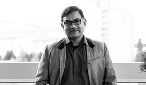
Ahead of Geo Insurance Europe and Geo Insurance US we caught up with Ed Parsons, Geospatial Technologist at Google to find out how he was instrumental in moving the focus of the Ordnance Survey to Geographical Information and how the insurance and reinsurance industry can benefit from fully embracing geo.
You were the first Chief Technology Officer for Ordnance Survey, and were instrumental in moving the focus of the organisation from mapping to Geographical Information – tell me about this transition/journey?
The major transition took place as a reflection of change; leadership saw technology as a new opportunity, whereas previously they had seen it as a cost line. There was a certain lifecycle of our products where maps would be edited and re-released every 10 years. We wanted to change this and develop other products, rather than just maps. The OS is essentially a big data base, where we have information of location for everything – there was huge potential for that to be used in other areas.
Over the years of working within this area what are the major changes you’ve seen?
The biggest and most notable change has been accessibility, we all have maps in our pockets! Previously you would have had to access specialised websites, libraries and companies to achieve such levels of geospatial information we have such easy access to now. We use it every day without even thinking about it, GPS systems are no longer a thing we have to go to Halfords’s for, because we have them on our phones. We have apps to tell us if our trains are going to be delays, and what station they are currently located. It’s fantastic what can now be done – when planning a journey in the car, you can see four hours ahead of you whether you will encounter delays in traffic, allowing you to make alterations so you don’t get caught in congestion. The best part is it’s all taken for granted, and had become part of the background in our daily lives, that’s how you know it is truly innovate.
What are the major challenges of using Geospatial data and technology of today?
The challenges aren’t so much within the technology but with understanding users. Are we understanding the different communities of users, and how their different needs impact the data and products we provide. The biggest challenge in terms of data has to be providing accurate, up to date and timely spatial content – It’s not good having outdated and incorrect data. I was on holiday with family in Tanzania, out on Safari I still was able to have 3G and 4G reception. In terms of technology we’re pretty advanced. The difficulty is staying up to speed with the meta data attached to the geospatial data, so for example business hours, and website which are attached to the maps – that is very challenging as they change so frequently.
What do you think the Insurance and Reinsurance Industry can gain by fully embracing Geo?
The Insurance industry knows how important geography is, as their core business is where risks happen and where they are located. However, some of the companies have an issue with the quality of geospatial data they are currently using. Take postcode data for example, which is often used at the basic building block of risk. At one end you could have a gated community, where the houses are all safely located out of a most risk categories. However, at the end of the postcode you could have a wooden shack, located next to a fireworks factory sat in the middle of a flood plain. Yet because these two dwellings are located in the same postcode they are assessed as having the same level of risk. More detail is required and although some companies have begun to move in this direction, I think they need a bit more of a push to fully embrace it and see it more as an opportunity for ROI and remaining competitive – rather than just as a cost and resource issue.
Why do you think it’s important to attend events like GeoInsurance Europe, 2019?
I love being able to explain the message of where geography is and where it’s going (machine learning etc.) It’s also a great opportunity to talk to people and interact with them – often Google struggles with having a human element, so that’s what I’m here to do, provide a face to the company. GeoInsurance Europe will be full of very professional and very focused individuals allowing for fantastic discussions around the latest geospatial developments, and that’s great.
Ed will be joining us at Geo Insurance Europe in London, 22-23 January 2019. To find out more and secure your pass visit the website here.
Author: Catherine King, Production & Content Director, Corinium Global Intelligence
.png?width=600&name=Geo%20Insurance%20Europe%202019%20(1).png)

.jpg?width=640&name=pexels-photo%20(2).jpg)


.jpg)

