The state of Victoria in Australia has officially unveiled its Digital Twin Victoria (DTV) platform, a digital replica of the state designed for data visualisation, exploration and planning.
The platform, built by the Victorian Government in partnership with Australia’s national science agency, CSIRO, is part of a $37.4 million investment by Victoria in digital twin technology and spatial data projects.
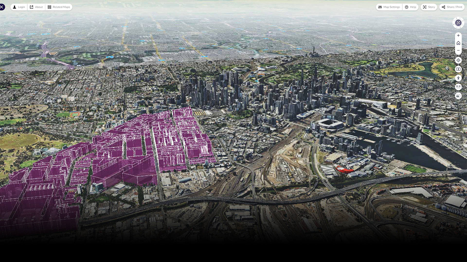
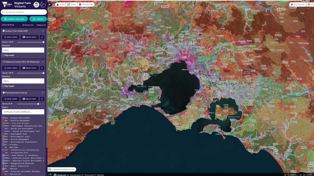
The platform brings 2D, 3D and live sensor data together in a web-based portal, in the style of a map overview.
Datasets can be uploaded into the platform, switched on and off, shared and compared.
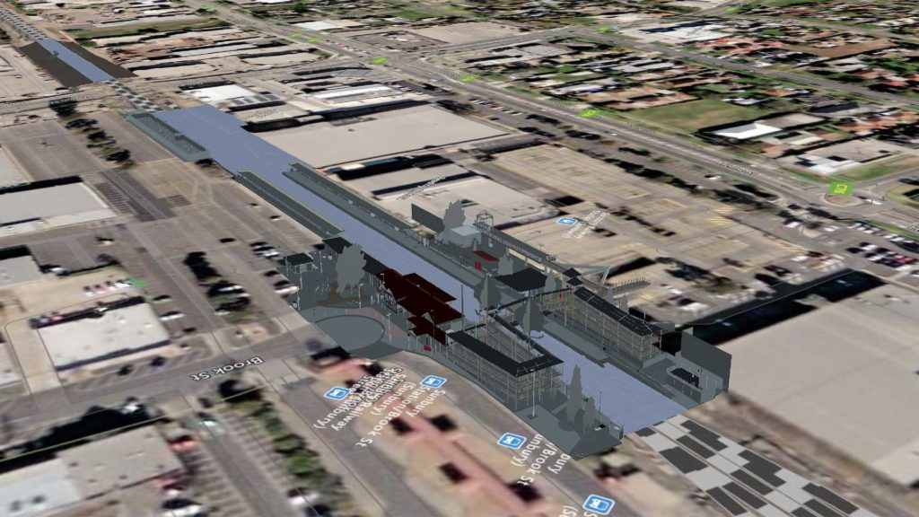
The platform also comes with many existing datasets (more than 4000, according to the Victorian Department of Environment, Land, Water and Planning) that can be turned on or off. Packaged datasets include building height-limit visualisations on certain suburbs in Melbourne, a huge photogrammetric model of central Melbourne, BIM data, planning and zoning data, pedestrian traffic data, coastal erosion data, flooding events data and more.
The DTV even comes preloaded with data of seal movement in the Bass Straight tracked between 2008 and 2009.
“With vast applications for projects large and small across industries, the DTV platform gives government, industry and the community more power than ever to make better data-led decisions, deliver faster and more efficiently,” an announcement on the DELWP website reads.
“It will help leave behind manual, labour-intensive and paper-based ways of doing things, building the digital foundations and skills needed to support a liveable and sustainable Victoria.
“Launching the DTV platform is a significant milestone, but it’s just the beginning. The DTV platform will continue to evolve and build over time, with more data and user feedback unlocking a myriad of new opportunities across the digital economy.
“Planners, engineers, developers and builders can use the DTV platform to visualise data, investigate the feasibility of proposals, troubleshoot issues and share complex information across workplaces and with decision-makers.”
The platform touts a set of tools for analysing and working with spatial data, including:
- Measuring objects
- Exploring at street level using pedestrian mode
- Using a timeline to see shadows moving throughout the data
- Saving 3D datasets using a clipping tool
- Sharing views with others
- Dataset comparison sliders
The Victorian State Government anticipates that the DTV project will fast-track smarter cities and regions, with councils able to bring together data of 3D building models, vegetation records, population stats and local sensor data to plan and manage cities.
The platform is live and can be viewed at the following link: https://vic.digitaltwin.terria.io/


